Continental Drift Theory of Alfred Lothar Wegener (1912)
Introduction
Less than 420 years ago, many scientists thought the continents always had been in the same place. It was difficult to accept that the continents and oceans were moving across the surface of the Earth, although the idea of a united continent was not new. A few scholars used to wonder why South America and Africa appear to fit together.
For example, Abraham Ortelius in 1596, Sir Francis Bacon in 1620 and Antonio Snider Pellegrini in 1858, in his book ‘Creation and Its Mysteries Unveiled’ (La créationet ses mystéres dévoilés), noted that the eastern coastline of South America and the western coastline of Africa looked as if they could fit together (fig. 1).
Alexander von Humboldt, one of the founders of modern Geography during his scientific expedition (1799-1804) across the Atlantic, grasped that this similarity is more than the apparent “fit”. The mountains of Brazil in South America were the same as those of the Congo in Africa. Therefore similarity between the eastern coastline of South America and the western coastline of Africa is not accidental.

However it was Alfred Lothar Wegener 1912, a 32-year-old lecturer in meteorology and astronomy in Germany, who propounded the Continental Drift theory with sound evidence (fig. 2). He delivered a lecture on “The Formation of the major Features of the Earth’s Crust (Continents and Oceans)” at Frankfurt in an eminent Geological Association. In his lecture, he suggested that continents had once been combined in the form of an original single sialic land mass and had afterwards broken apart and drifted to their present positions.
Later in 1915, he circulated an exposition of his theory of continental drift titled The Origin of Continents and Oceans (Die Entstehung der Kontinente und Ozeane). He revised the book extensively three times. The revised editions with further elaborations appeared in 1920, 1922, and 1929. His theory attracted little notice from the scientific community of his day, and publication had a small circulation. Later plate tectonic theory revived and revised interest in his theory.

Continental Drift Theory
Wegener said that all the continents could be joined together like giant puzzle pieces to create one primordial supercontinent, i.e. PANGAEA means all land (fig. 3). It occupied about half of the planet’s surface area and existed 300 million years ago. This gigantic continent was surrounded by a shallow single vast ocean called PANTHALASSA, meaning “all sea”.
In the carboniferous age, the South Pole was near the South African coast and the North Pole was situated in the Pacific Ocean. He said 200 million years ago, during the Mesozoic era, PANGAEA began to separate into two proto-continents viz. a northern continent (Laurasia = North America, Europe, Greenland and Asia excluding India), and a southern (Gondwanaland = South America, Africa, India, Australia, New Zealand and Antarctica) (fig. 4). The two proto-continents were separated by Tethys sea. The exact boundaries of these two domains are still in question. Opinions are also divided on the date of the splitting up of the PANGAEA.

The continents drifted away from the contemporary poles. Wegener described this phenomenon as Polflucht, or flight from the poles. By the end of the Cretaceous period, the continents were separating into land masses that resembled the shape of our present-day continents. Wegener assumed that land masses horizontally moved on the viscous sea floor. The modern-day position of continents is the outcome of this horizontal drifting. Wherever the drifting continent faced resistance in the way of movement, it resulted in huge fold mountains. Therefore, his book provided a new reason for the construction of mountain chains.
It is interesting to note that “Wegener’s term for this motion, the German word verschiebung, would be most accurately translated as displacement. The theory nevertheless became known in English as continental drift” (Yount, 2009).


The continents in the present time are attaining their maximum distances. Their continued motion in the future must bring them closer together again. In the future, 200 million years from now, South America, Antarctica, and Australia are likely to join together in the southern hemisphere (Fig. 6). Similarly, Africa, Europe, and Asia are likely to unite in future (Meadows, 2007).
Mechanism of Drifting
Wegener knew that his drifting hypothesis must also explain the mechanism of Drifting or what moved them. Wegener thought that the oceans are composed of heavier material than the continents. Thus, he deduced that the less dense continents are floating on, the heavier the subsurface.
It doesn’t mean that he was advocating for an isostatic balance between the different crustal segments of the upper portion of the earth; rather, he was interested in the logic of horizontal drifting. It was clear to him that drifting would require an enormous amount of energy. Therefore he attempted to attribute the drifting process to “Eotvos” or pole-fleeing and external tidal force.
Pole-fleeing or Centrifugal Force:
The spinning of Earth on its own axis creates a centrifugal force, i.e. force oriented away from the axis of rotation towards the equator. Wegener believed the centrifugal force of the planet caused the supercontinent to break apart and pushed continents away from the Poles toward the equator. Therefore, He called this drifting mechanism as the “pole-fleeing or centrifugal force”.

Tidal Force
Wegener tried to attribute the westward drift of the Americas to lunar-solar drag, i.e. by invoking tidal force that is the gravitational forces of the sun and the moon (Fig. 8). He also admitted that “it is probable” that pole-fleeing or centrifugal force and tidal force are responsible for the journey of continents. He left many questions unanswered in the context of the mechanism of drifting.

Wegener’s suggestion to relate the drifting process to centrifugal force and external tidal force was the weakest point of his theory. It was also an idea of “impossible hypotheses for geophysicist Harold Jeffery. In his book The Earth, Its Origin, History and Physical Constitution, Jeffery asserted that the Earth’s crust is too strong to be affected by these forces.

Evidence in Support of the Continental Drift Theory
Science requires the use of methods that are systematic, logical, and empirical. To support his theory, Wegener gathered empirical evidences from a variety of scientific methods. He knew that the truth of drift can only be achieved by combining all possible evidences. These scientific evidences are as follows:
The Shapes Match: Jig-Saw-Fit
In a letter to Else, the daughter of climatology expert Wladimir Köppen Wegener raised a question, i.e. “Doesn’t the east coast of South America fit exactly against the west coast of Africa, as if they had once been joined?” (Yount, 2009). Later Wegener also married Else. Wegener’s idea was not new since his great-granduncle’s friend Alexander von Humboldt was already aware of this jigsaw puzzle (fig. 6).

The Identical Fossils of Plants and Animals
Snider-Pellegrini recorded that fossil plants from the Carboniferous period (354–290 million years ago) in Africa and the Americas are largely identical. Later Paleontologists were satisfied to accept that land bridges connected present-day continents, and later these land bridges sank beneath the sea. The land bridges in the past would have been helpful for the animals to cross since it was impossible to cover the distance via the Atlantic Ocean.
Another possibility for migration of specifies across the Atlantic was ruled out by the balancing act of isostasy. Wegener’s theory became controversial because it presented alternate reasons for the fossils’ similarity. He said continents were joined together in the form of a single landmass. Therefore there was no barrier in the form of the present-day Atlantic Ocean. This means that they evolved together on a single large landmass Gondwanaland. He reasoned that it was physically impossible for most of these organisms to have travelled or been transported across the vast oceanic barrier.

For instance, Lemurs found in India, Madagascar, and Africa validate that India was connected with Africa via Madagascar in the past (Fig.12).

The remains of Cynognathus, a Triassic land reptile and Mesosaurus, a type of Freshwater reptile, are found in South America and Africa.

Similarly, the remains of Lystrosaurus (A Triassic land reptile) are excavated in Africa, India and Antarctica. The Glossopteris (Gondwana plant fossil) can be found in widely separated present-day continents. Therefore more or less, the identical fossils of plants and animals found in a different part of Gondwanaland validate his argument for “all land,’ i.e. PANGAEA.

The identical fossils of Plants and Animals in Europe and northeastern North America were not very apparent, but Wegener noticed that earthworms are found in Europe and the northeastern areas of North America. Earthworms cannot swim across Atlantic Oceans. It suggests that the Atlantic Ocean did not exist in the past.
Comparative Stratigraphy: A Similar Sequence of Rocks at Numerous Locations
The comparative stratigraphy is the study of a similar sequence of rocks at numerous Locations (Fig. 15). Layers of the same rocks can be recorded many kilometres apart. By sequencing and mapping them, geologists can figure out how they extend underground or split apart because of continental drift.

In this regard, Wegener’s most compelling support came from the eminent South African field geologist Alexander Du Toit. After spending five months in Brazil, Uruguay and Argentina, he wrote in his book ‘A Geological Comparison of South America with South Africa (1927)’ that ‘The Brazilian strata [layers of sedimentary rock] correspond perfectly in every detail to the strata series of the southern African shield.” Du Toit further wrote that he had “great difficulty in realizing that this was another continent,” i.e. South America. The mixed sequence of glacial and marine deposits in South Africa and South America also confirmed that two landmasses had once been joined. Alexander Du Toit produced a considerably more detailed body of evidence than Wegener himself had.

The Caledonian mountains of North America reappear in Scotland and Northern Ireland and match in terms of age and structure with the Appalachian Mountains of North America (Fig. 16). Similarly, the radiometric dating method, together with stratigraphic principles also reveals that broad belts of rocks in Africa and South America are the same type.
The Ice Matches: Glaciers and Tillite
Wegener was also an expert in the field of palaeoclimatology. He had written a book on palaeoclimatology under the guidance of his father-in-law, Wladimir Köppen. Wegener was aware that a continental ice sheet covered parts of South America, southern Africa, India, and southern Australia about 270 million years ago during the late Paleozoic times (fig. 17).
Glacial striations on rocks show that glaciers radiated outward from the glacial centre over the South Pole in Africa toward the Atlantic Ocean and from the Atlantic Ocean onto South America. Therefore, the continents must have been joined to move the ice across a single landmass Pangaea. The presence of glacier evidence, in turn, supported the idea of polar wandering.

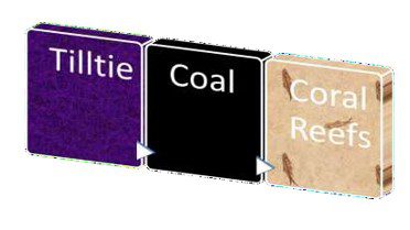
The presence of tillite, that is, sedimentary rock formed out of deposits of glaciers in India, Madagascar, Africa, Antarctica and Australia, further revealed that these landmasses had amazingly parallel pasts.
Wegener also raised an interesting question, Why is there a huge stock of coal across present-day cool middle latitude parts of the earth? Coal can be found in North America, Europe, Asia Minor, China and even under the Antarctic ice cap. This huge stock of coal can only form in equatorial climatic conditions. It would have been if the poles were in the location Wegener described.
Similarly, the remains of the Coral reef, which requires warm water to survive, can be found in the cold North Polar Region. Therefore It also supported the drifting hypothesis. (Fig. 18)
Why was his theory considered as an impossible hypothesis?
Wegener’s Continental Drift theory was not readily accepted by the scientific community of his day. Generally, scientific hypotheses contradicting the dominant theory, principle, or prevailing contemporary view invite criticism. Wegener’s theory was no exception to it.
Wegener failed to devise a sound mechanism for the movement of the continents. For Wegener, the drifting mechanism was the most difficult question to solve. He tried to attribute the westward drift of the Americas to feeble lunar-solar drag. J.A. Steers (1992) said, “such a force is extraordinarily small”. Even if we accept that “tidal force was powerful enough to drag Americas”, then it would have stopped the rotation of the earth within a year. It was also difficult to imagine how compression could be possible to raise Andes and Rockies (mountain chain) due to a lunar-solar drag of sialic landmass over the rigid sima-floored ocean (Panthalassa).
Geologists also raised questions about the exact fitting of the opposing coasts of the Atlantic. It was also assumed that the approximate fit of the continents may be a coincidence created by the erosion process.
Modern Developments and Continental Drift Theory
Within 40 years of the denial of Continental drift theory by contemporary much of the geological Community, the main idea of horizontal movement of continents has become part of plate tectonics theory. The technological developments leading to the opening up of ocean basin geology have uncovered the Mid-Oceanic Ridge system in the middle part of the Atlantic Ocean. The discovery of “Mid Oceanic Ridges” added a new dimension to the drifting mechanism.


In the shadow of continental drift, British geologist Arthur Holmes (1890–1965) proposed the concept of convection currents mechanism to explain the drifting of the continents. To understand the convection current mechanism, take a pan of boiling water and put a piece of cork in it. You will observe that cork on the surface of the boiling water will be pushed sideways (figure 19).

In his well-known textbook The Principles of Physical Geology, Holmes suggested that, similarly, the convection currents in the upper part of the mantle may perhaps cause the movement of the continents. Later in 1962, Professor Harry H. Hess, in his seminal paper on the concept of seafloor spreading, agreed with Arthur Holmes’s idea of convection current mechanism (Fig. 20). Recently, the Palaeomagnetic (fossil magnetism) evidence from the rocks found along the Mid Oceanic Ridge system revived interest in original single sialic land-mass, i.e., PANGAEA.
- Additional evidence of seafloor spreading came from an unexpected source, i.e., petroleum exploration.
- The drifting of the present-day continents can be recorded directly through the satellite-linked Global Positioning System.
The Journey of India in Continental Drift
In the 1950s, the sensitive magnetic inclination samples collected from the instrument called a magnetometer in the Deccan Plateau region of peninsular India showed amazing findings. The magnetic inclination samples confirmed that the region had previously been in the Southern hemisphere, as proposed by Wegener.
For example, the 150 million years old rock manifested a magnetic inclination of 64 degrees south. The geologists were surprised to note that rocks dating 25 million years old in the Deccan Plateau region entirely inverted their magnetic inclination. This sensitive magnetic inclination record confirmed that India used to be part of Wegener’s Gondwanaland.

The anticlockwise journey of India from the Southern Hemisphere reveals that it rammed into Asia about 40 to 50 million years ago. The northward advance of India caused the rise of the earth’s tallest mountain, i.e. The Himalayas. In just 50 million years of Earth’s reconstructed history, peaks such as Mt. Everest have risen to heights of more than 8 kilometres. (Fig. 20)
What can a young geographer learn from Alfred Wegener?
The perseverance, and patience with empirical observations was the most important attribute of his personality despite the initial mockery of his theory. It took nearly 60 years for the idea of continental drift to be scientifically confirmed in the form of plate tectonic theory. Ultimately, it added a new dimension to understanding the global distribution of earthquakes and volcanoes and identifying disaster-prone areas.
Read More in Geomorphology
- Earth Movements: Meaning and Types
- Epeirogenic Earth Movements
- Orogenic Earth Movements
- Cymatogenic Earth Movements
- Concept of Stress and Strain in Rocks
- Folds in Geography
- Fault in Geography
- Mountain Building Process
- Morphogenetic Regions
- Isostasy: Concept of Airy, Pratt, Hayford & Bowie and Jolly
- Continental Drift Theory of Alfred Lothar Wegener (1912)
- Plate Tectonics: Assumptions, Evidences, Plate Boundaries and Features Formed
- Volcanoes: Process, Products, Types, Landforms and Distribution
- Earthquakes: Processes, Causes and Measurement
- Plate Tectonics and Earthquakes
- Composition and Structure of Earth’s Interior
- Artificial Sources to Study Earth’s Interior
- Natural Sources to Study Earth’s Interior
- Internal Structure of Earth
- Chemical Composition and Layering of Earth
- Weathering: Definition and Types
- Mass Wasting: Concept, Factors and Types
- Models of Slope Development: Davis, Penck, King, Wood and Strahler
- Davis Model of Cycle of Erosion
- Penck’s Model of Slope Development
- King’s Model of Slope Development
- Alan Wood’s Model of Slope Evolution
- Strahler’s Model of Slope Development
- Development of Slope
- Elements of Slope
- Interruptions to Normal Cycle of Erosion
- Channel Morphology and Classification
- Drainage System and Drainage Pattern
- River Capture or Stream Capture
- Stream Channel Pattern
- Fluvial Processes and Landforms: Erosional & Depositional
- Delta: Definition, Formation and Types
- Aeolian Processes and Landforms: Erosional & Depositional
- Desertification: Definition, Problem and Prevention
- Glacier: Definition, Types and Glaciated Areas
- Glacial Landforms: Erosional and Depositional
- Periglacial: Meaning, Processes and Landforms
- Karst Landforms: Erosional and Depositional
- Karst Cycle of Erosion
- Coastal Processes: Waves, Tides, Currents and Winds
- Coastal Landforms: Erosional and Depositional
- Rocks: Types, Formation and Rock Cycle
- Igneous Rocks: Meaning, Types and Formation
- Sedimentary Rocks: Meaning, Types and Formation
- Metamorphic Rocks: Types, Formation and Metamorphism
- Morphometric Analysis of River Basins
- Soil Erosion: Meaning, Types and Factors
- Urban Geomorphology: Concept and Significance
- Hydrogeomorphology: Concept, Fundamentals and Applications
- Economic Geomorphology: Concept and Significance
- Geomorphic Hazard- Earthquake: Concept, Causes and Measurement
- Geomorphic Hazard- Tsunami: Meaning and Causes
- Geomorphic Hazard- Landslides: Concept, Types and Causes
- Geomorphic Hazard- Avalanches: Definition, Types and Factors
- Integrated Coastal Zone Management: Concept, Objectives, Principles and Issues
- Watershed: Definition, Delineation and Characteristics
- Watershed Management: Objective, Practice and Monitoring
- Applied Geomorphology: Concept and Applications